
THE Dorset Echo can reveal the full extent of the floods and storm damage affecting the region.
These spectacular images were captured as local authority representatives took to the skies to work out the impact of the recent wild weather in Dorset.
For more aerial photos of flooded Dorset click here.
New warnings have been issued following the aerial survey urging residents to stay away from unstable cliffs and the beaches, especially along the coastline and rivers.
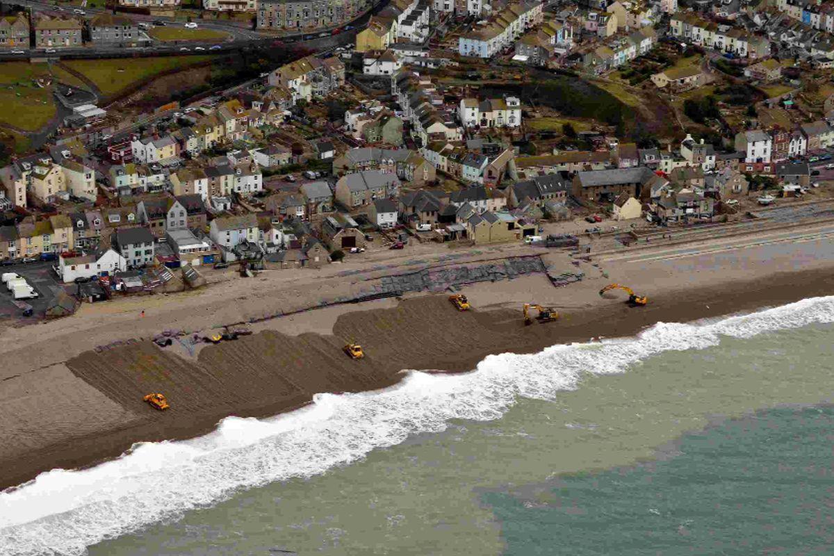
Outstanding features included the erosion along Chesil Beach and the rest of the coast as well as damage caused by flooding in East Dorset surrounding the Avon and Stour valleys.
Representatives from Dorset Police, Dorset County Council and the Environment Agency met at Bovington to board the RAF helicopter as the county begins its clean-up operation.
It comes after some of the most devastating storms hit the Jurassic coast, leaving Dorset with an estimated overall repair bill of millions of pounds.
A hurricane force storm struck on Friday evening causing chaos for many communities.
Beaches and seafronts have been devastated, hundreds of properties flooded and farmland unusable for many months.
Earth science manager Richard Edmonds, of Dorset County Council’s Jurassic Coast Team, was among those who took the skies.
Mr Edmonds said: “The helicopter survey was a really useful way to get a quick overview of most of the coast and the flooding of the Avon and Stour valleys.
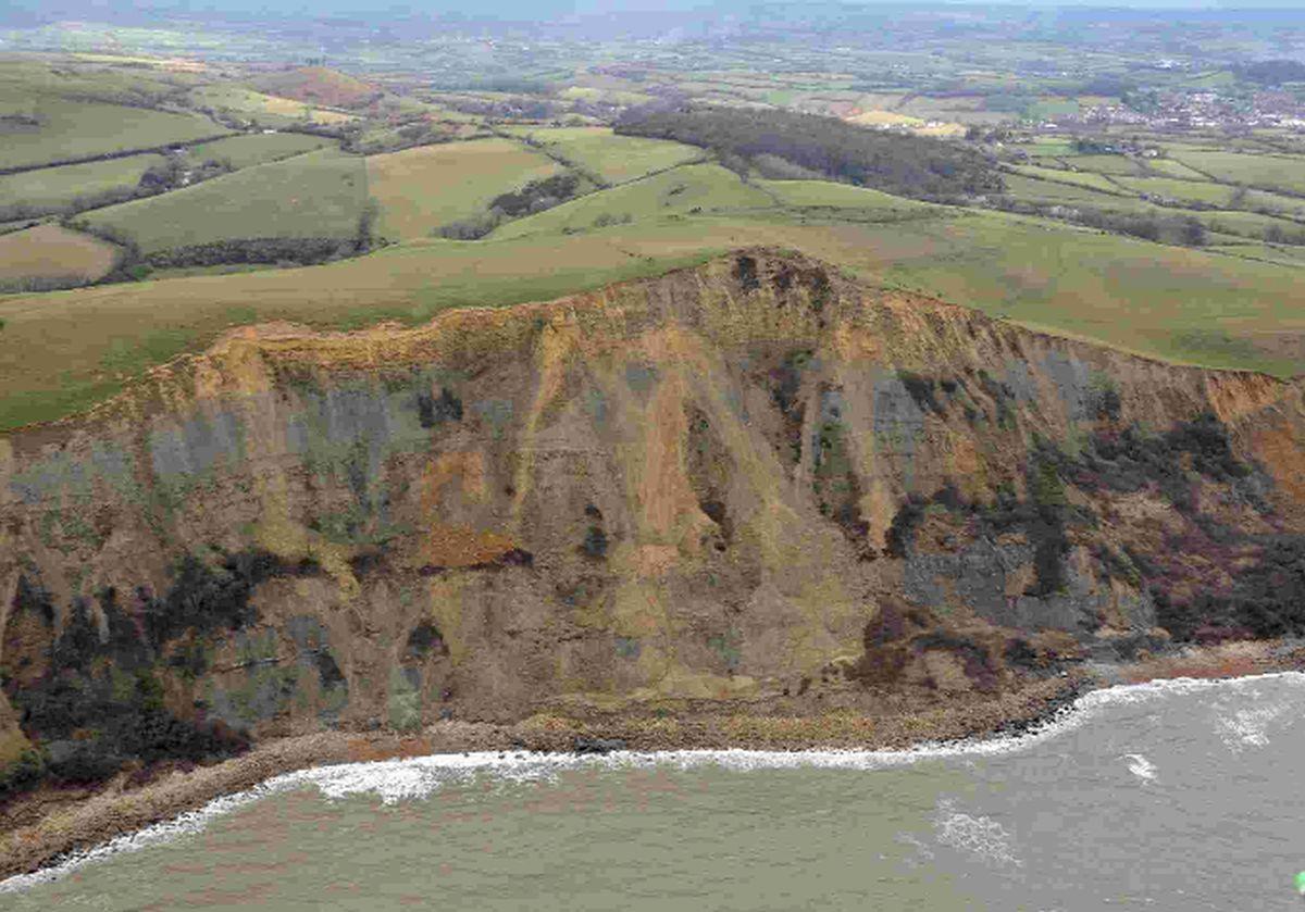
“My interest is the coast particularly and I have been able to make a quick survey of the significant or potentially significant erosion of the cliffs and the changes to Chesil Beach.”
He is now urging residents to take heed of warning signs to stay away from unstable cliffs and the beaches below them.
He added: “While it is impossible to predict from this, or any other survey approach, where the next rock fall or landslide may take place, I was really surprised by the number of obviously fresh rock falls in the cliffs between Freshwater and Burton Bradstock.
“I would also add that the same applies to the cliffs from Freshwater to West Bay.
“The base of these cliffs have taken a massive pounding by the sea and that considerably increases the probability of rock falls.
“Stay away from the base of cliffs and cliff tops.
“There is an increased risk of rock falls and landslides over the next few weeks and months.”
Dorset photographer Geoff Moore said: “It was an incredible sight.
“Only from the air can the true extent of the flooding be seen.”


Comments: Our rules
We want our comments to be a lively and valuable part of our community - a place where readers can debate and engage with the most important local issues. The ability to comment on our stories is a privilege, not a right, however, and that privilege may be withdrawn if it is abused or misused.
Please report any comments that break our rules.
Read the rules hereLast Updated:
Report this comment Cancel